SUMMARY: A high-resolution topographic survey of Lake Elaine conducted via drone photogrammetry to support site development planning. The project required low-altitude flights in controlled airspace over a sensitive residential area and precise data processing to generate CAD-ready deliverables.
SITE and OBJECTIVE: Lake Elaine is a 65 acre site in Southeast Flagstaff, AZ. The site features a drained lake that is surrounded by multiple residential structures in a ponderosa pine tree forest. Objectives for this project were to capture aerial imagery to create an orthomosaic image, and produce mass points and break lines so that the client, Ardurra, a surveying and engineering firm) could produce a topographic surface for further engineering design work.
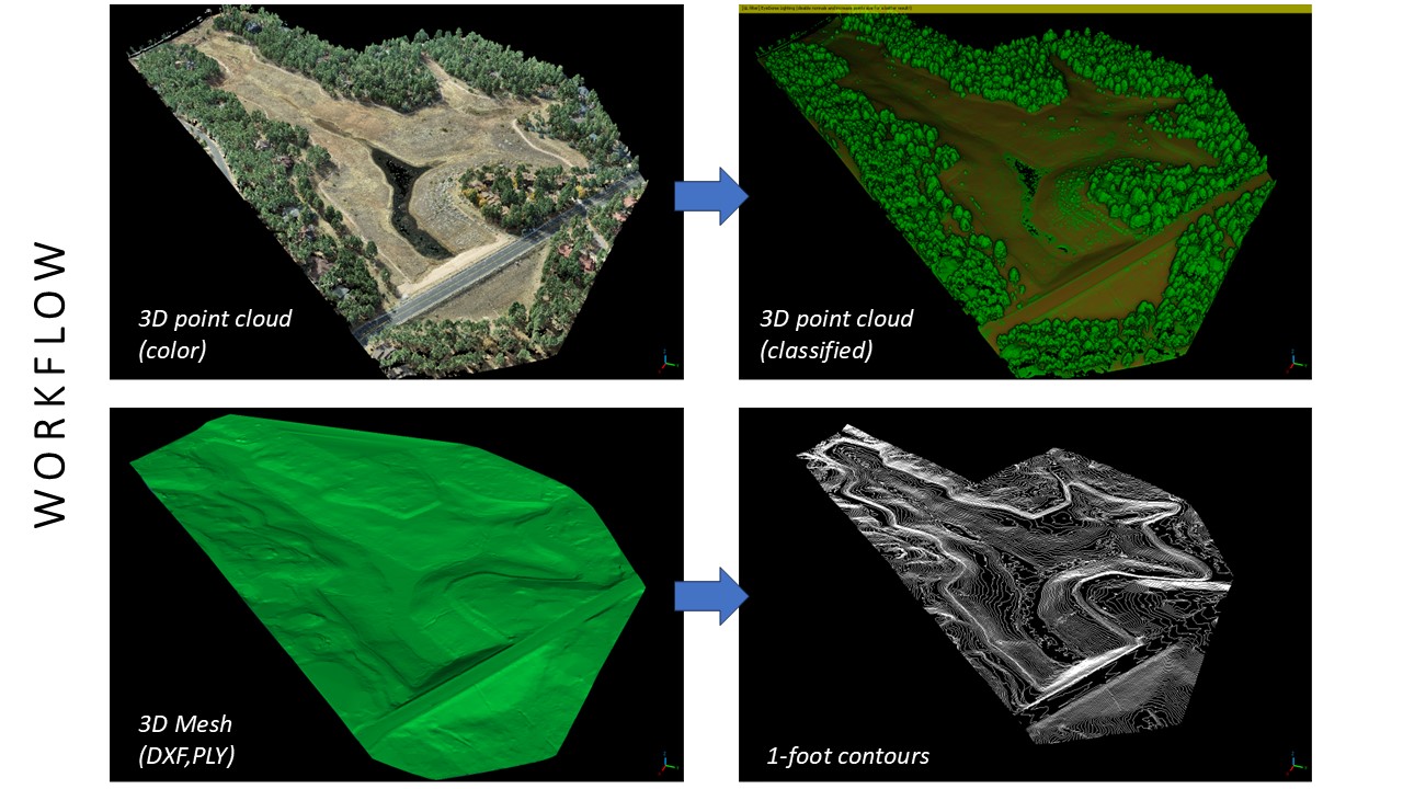
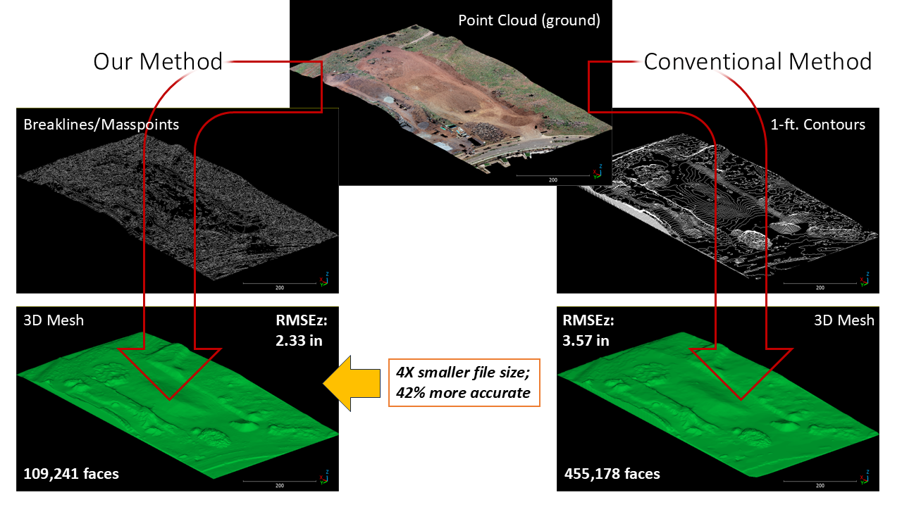
WORKFLOW: The surveyor set 10 Ground Control Points (GCPs) throughout the Area of Interest (AOI). The AOI was then flown and Structure from Motion (SfM) processing was used to create a GEOREFERENCED point cloud. That point cloud was then classified into ground and non-ground points, from which mass points and breaklines are created. This workflow produces much more accurate and efficient (in terms of file size) surfaces than other methods.
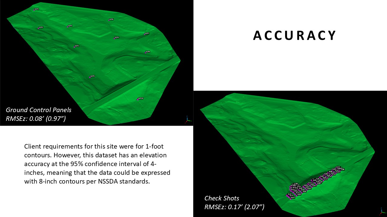
ACCURACY: Pretty point clouds are nice to look at, but what really matters is accuracy of data. The surveyor shot a number of additional points on the site which we used as check shots to test data accuracy. Client requirements for this site were for 1-foot contours. However, this dataset has an elevation accuracy at the 95% confidence interval of 4-inches, meaning that the data could be expressed with 8-inch contours per NSSDA standards.
Lightforce Media is Ardurra’s go-to resource for aerial topo work. Need a drone-based topo survey? Contact us to discuss your project.