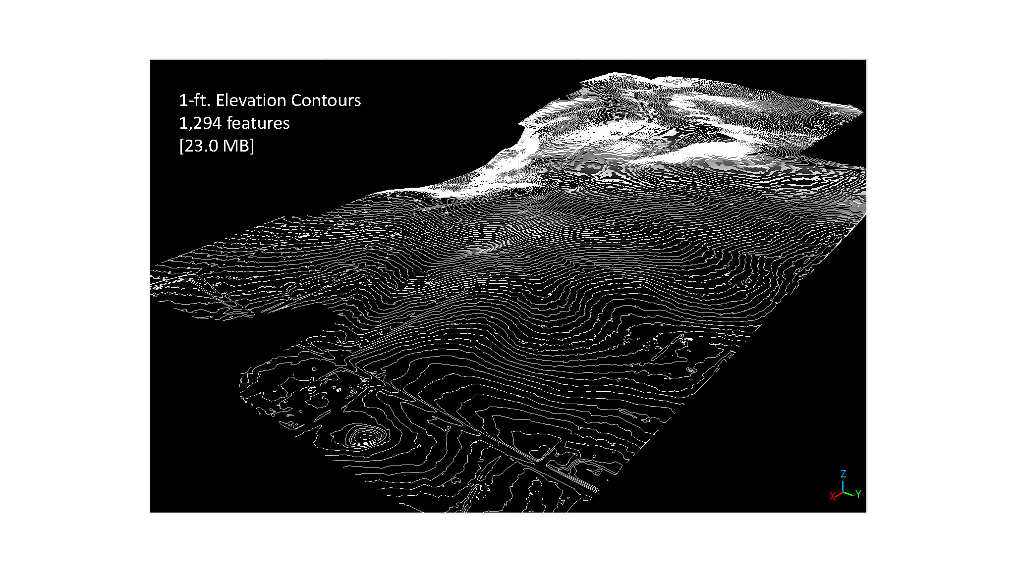
SUMMARY: A high resolution topographic survey of Rim Side, a 132 acre lot split survey to support development planning. This project required the use of LiDAR to penetrate through a dense forest canopy to create accurate topo products.
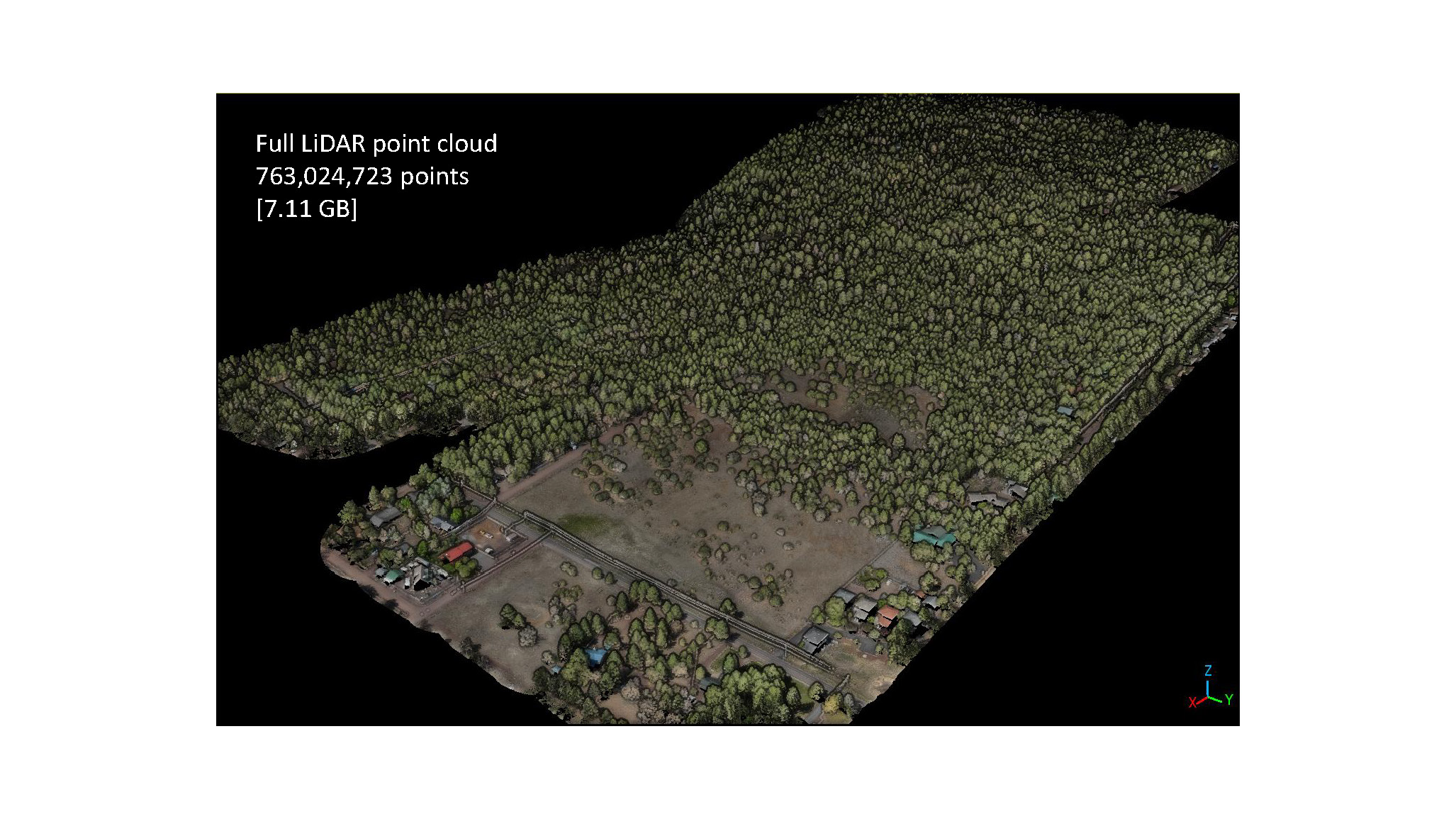
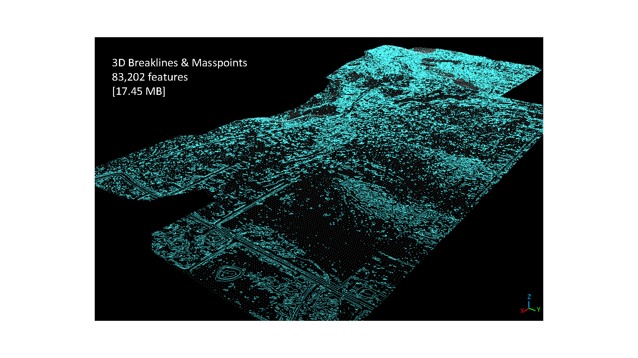
SITE and OBJECTIVE: Rim Side is a 132 acre parcel in Pinetop-Lakeside, AZ. This site is on the Mogollon Rim, and provides panoramic views of the surrounding area from the top of the rim. Objectives for this project were to capture RGB imagery and LiDAR data to produce an orthomosiac image, Mass Points and Break Lines, so Infinity Land Surveying, could create a design ready surface.
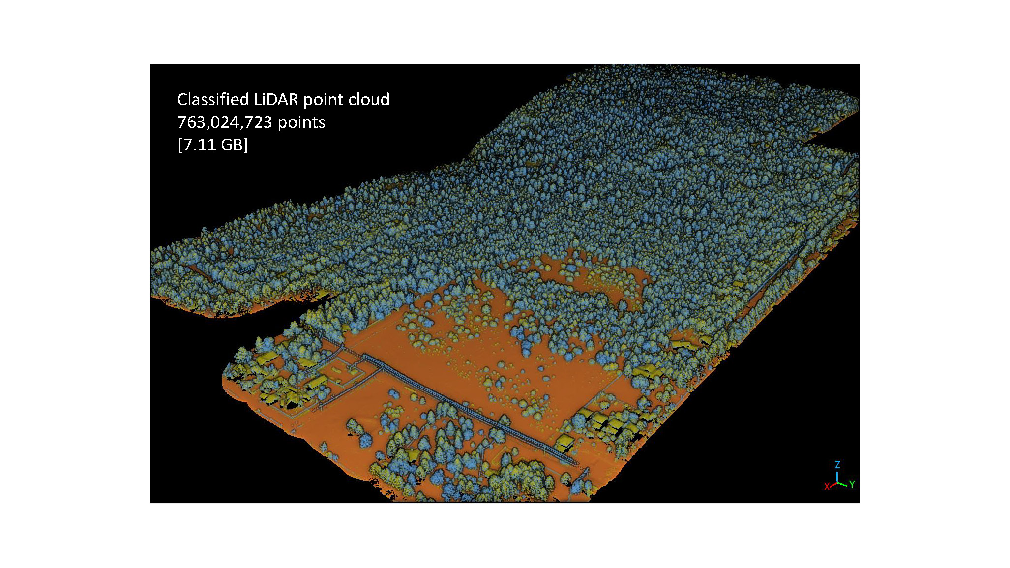
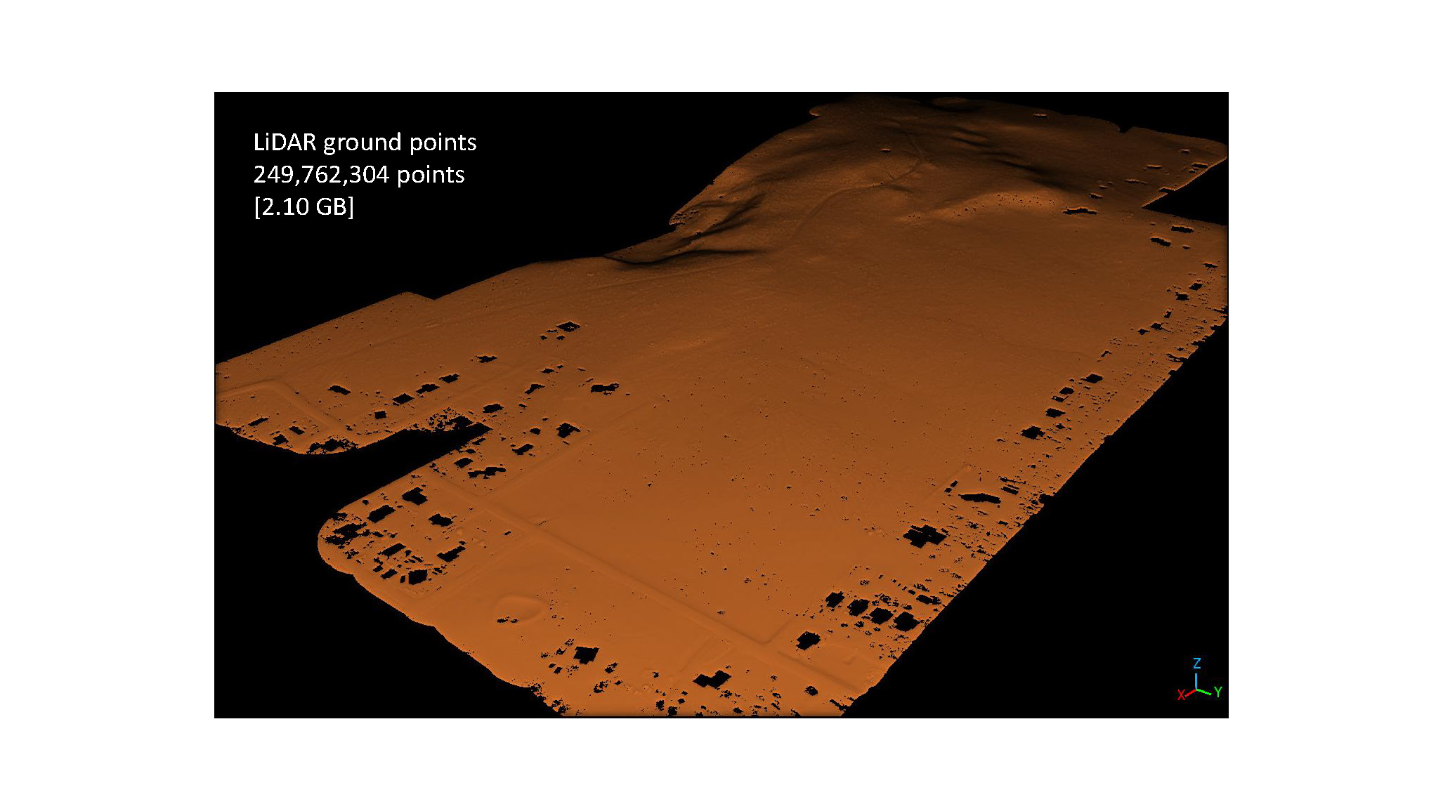
WORKFLOW: Infinity Land Surveying, set 11 Ground Control Points (GCPs) throughout the Area Of Interest (AOI). The AOI was then flown with a LiDAR and RGB camera sensor. LiDAR data was georeferenced, and a ground extraction was performed to classify the data into ground and non-ground points, from which mass points and break lines were created. RGB camera data was also georeferenced and used to colorize the LiDAR data as well as create an orthomosaic image of the entire site.
Drone LiDAR is a powerful mapping tool that rapidly captures high-precision elevation and terrain data, even through dense vegetation or in hard-to-reach areas. When combined with survey ground control and processed correctly, the output data is highly accurate, informative, and actionable for all sorts of design, research, monitoring, or other purposes. Please reach out to us to learn how LiDAR data can help support your next project.